

Area: 43.70 km2
Population: 2,794 inhabitants (2021 Census)
"São Vicente is a region, where there are gentlemen in coats, where are large breed roosters, who make a beautiful lot. Ponta Delgada is for limpets, with fine sea beaches, where the coastal steamers, They make a port to return. Boaventura has water, which irrigates a lot of vimieiro. There's a lot of bogança and beans, which are worth a lot of money."
HISTORY
It is unknown when the settlement of the northern slope of the island began. The difficulties of penetration, by sea and land, would have been a consideration for potential interested parties and certainly acted as an obstacle to its humanization.
Therefore, it is known where the construction of the first town began, resulting from the determination of the 1744 charter that created the municipality. It was traced on the left bank of the Ribeira, a place sheltered from the greedy gaze coming from the sea, where the new church had been located since the 15th century.
São Vicente was, since the 15th century, the main and most important settlement center in the north of Madeira, which accompanied the slow progress of this northern slope. Only in 1745, with the full exercise of the municipality of São Vicente, did the north have the right to a documentary record of their concerns and daily reality, when they visit the chamber's senate gallery.
Economic activities: Agriculture (vineyard), commerce, services, industry (hotel, civil construction, bakery, tourism, aggregate extraction, winery, cement articles, furniture, wood processing, metalwork).
Festivals and Pilgrimages: São Vicente (24th to 31st August), Nossa Senhora do Rosário (1st Sunday of October), Nossa Senhora da Saúde (1st Sunday of August – Lameiros) and Nossa Senhora da Paz (last Sunday July – Feiteiras).
Heritage: Capelinha do Calhau, Capelinha do Pico da Cova, Capelinha do Livramento (Feiteiras) and main church.
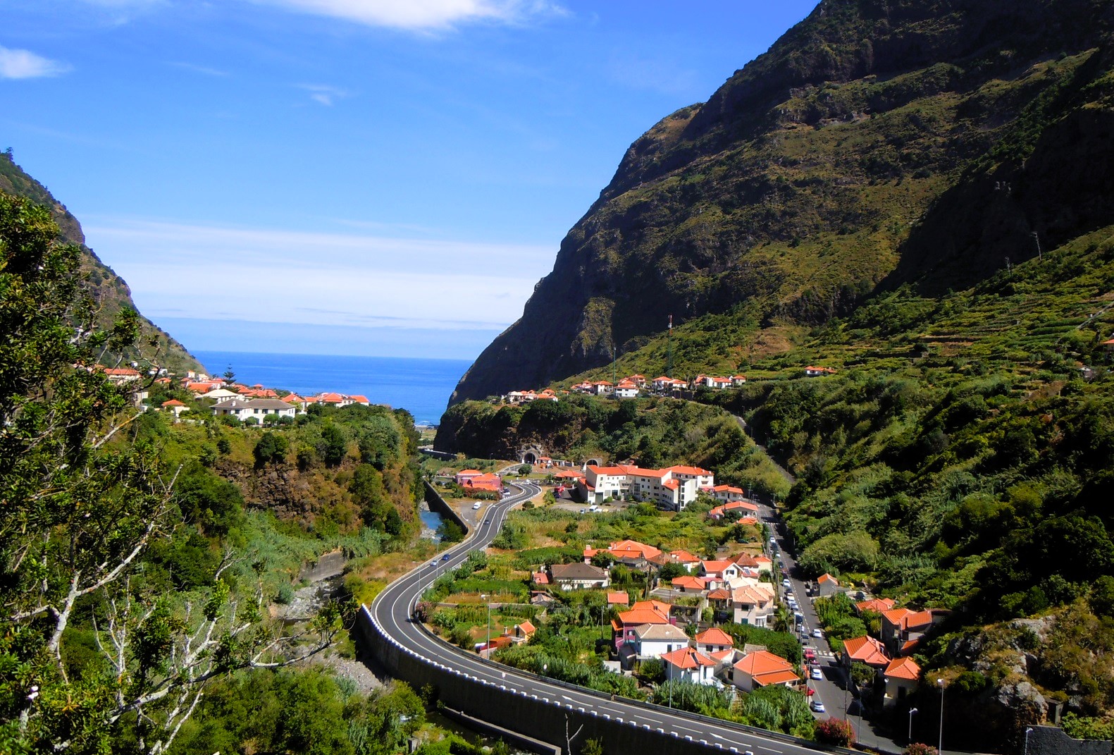
Other Locations: Garden of Indigenous Plants, Natural Caves of São Vicente and Volcanism Center, Lombo Garcês, Caramujo, Chão dos Louros, Bica da Cana, Encumeada, Pico da Cova, Fajã de Cima, Miradouro da Encumeada, Housing Tourism (House da Piedade, solar da Bica and Casa do Lanço).
Gastronomy: Kebab, wine and garlic meat, couscous, pilgrimage broth, honey cake, sausage, poncha, wheat and cabbage soups, white yam, limpet rice, snails, grilled limpets, homemade bread, semilha, local wine region.
Crafts: Weaving, blacksmithing, embroidery, wicker basketry, tinsmithing, plastic arts and shoemaking.
Patronage : São Vicente
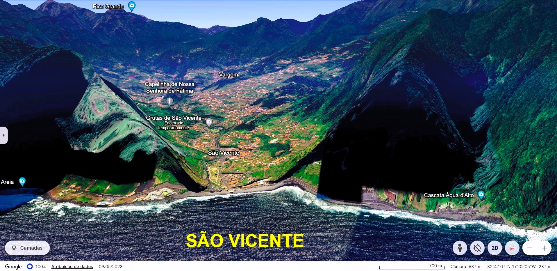
GEOGRAPHICAL SITUATION
It has a coast on the Atlantic Ocean, to the north, bordering the parishes of Seixal (Porto Moniz municipality), to the West, Canhas (municipality of Ponta do Sol), to the Southwest, and Serra d'Água (Ribeira Brava municipality), to the South.


The Igreja Matriz de São Vicente, located in the center of the town, has an eclectic construction, dating from 1692. Its facade is simple and its portal is mannerist.
Inside the Church, some artistic treasures stand out, such as the painting of Saint Vincent blessing the town, on the the church ceiling, and the magnificently carved main altar.
On the left side wall is the baptismal font in stonework with mannerist characteristics.


SÃO VICENTE BEACH


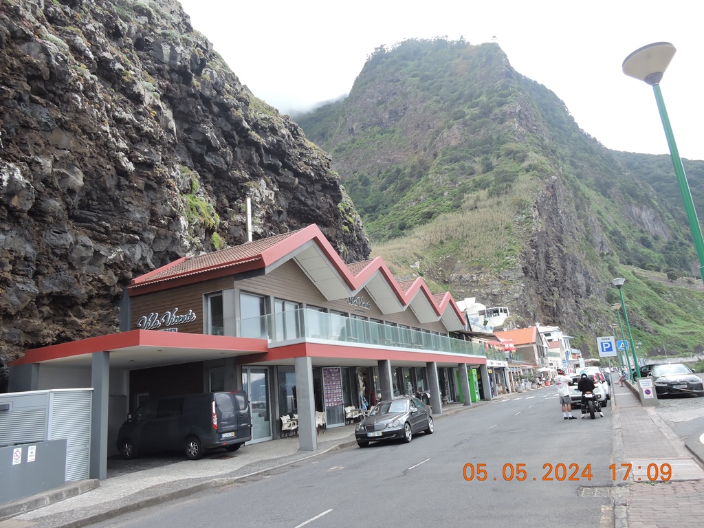


São Vicente Beach;
Àgua d'Alto Waterfall;


Sem comentários:
Enviar um comentário